Climate trends in the Pacific Ocean called El Niño and La Niña can have an adverse impact on weather all across the world.
The weather patterns of our planet are greatly affected by the forces of El Niño and La Niña. Join us in this exploration as we delve into the intricacies of these phenomena, delving deeper into their profound influence on Earth’s atmospheric conditions.
What is El Niño?
‘El Niño’ is a term we use a lot to talk about how the sea gets warmer every few years, especially in the central-east part of the Pacific Ocean.
We say there’s an El Niño when the sea in the tropical eastern Pacific gets about 0.5 °C warmer than usual. This makes the weather extra warm in that area.
The strongest effects of this usually happen in December. Long ago, Peruvian fishermen called it “El Niño de Navidad,” which means “the Child of Christmas.” They did this because it often started around Christmas time, kind of like a new baby arriving.
After a gap of seven years, something interesting is happening in the tropical Pacific – This could lead to hotter temperatures worldwide and some changes in weather and climate.
According to the latest news from the World Meteorological Organization (WMO), there’s a really high chance (90%) that this El Niño will stick around for the rest of 2023. They think it’s going to be decently strong, but not too crazy. The WMO gets input from experts all over the world to make these predictions.
What is El Niño meaning?
In Spanish, “El Niño” actually means “Little Boy”!
What is La Niña?
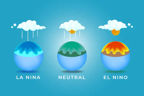
Imagine a weather dance where we have “La Niña. It’s like the opposite of El Niño. During La Niña, things get cooler in the equatorial Pacific, with sea surface temperatures dropping below what’s usual.
Different experts have slightly different rules for saying it’s La Niña time, but when it happens, the sea can get as much as 3-5 °C colder than usual. This brings cooler and drier weather to the tropical eastern Pacific.
There’s also a middle part where things are kind of average, called the neutral phase. It’s like a balancing act, where conditions are pretty close to what they usually are (within +/- 0.5 °C). These neutral times might happen in between the warmer and cooler phases.
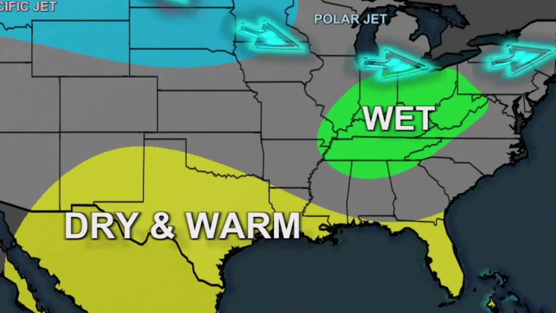
Cold waters in the Pacific Ocean make something called the “jet stream” move up north. This can bring dry weather to the southern U.S. and lots of rain, even floods, to the Pacific Northwest and Canada.
In a La Niña year, winters become warmer than usual in the South but cooler in the North. Also, La Niña might make hurricanes during the season even stronger.
What is El Niño meaning?
In Spanish, “La Niña” means “Little Girl”!
What is The Difference between El Niño and La Niña?

El Niño and La Niña are like two sides of a coin in a weather pattern called the El Niño/Southern Oscillation (ENSO). This pattern shows how things change a lot from year to year in the equatorial Pacific Ocean, like sea temperatures, rainfall, air pressure, and how the air moves around.
When we talk about El Niño, we’re talking about when sea-surface temperatures get warmer than usual in the east-central equatorial Pacific. It’s like the warm part of the ENSO cycle. Now, La Niña is when things cool down with lower sea-surface temperatures in the same area. This is the cold part of the ENSO cycle.
How Often Does El Niño Occur?
Think of El Niño and La Niña events like visitors who come to the equatorial Pacific every 2 to 7 years, and they stay for around 9 to 12 months, although sometimes they hang around for even longer. The experts at the National Oceanic and Atmospheric Administration (NOAA) tell us that El Niño shows up more often than La Niña.
How Long Does El Niño Last?
This events have an average duration of around 9 months. These events tend to originate in the northern hemisphere’s summer or fall, experience their peak during the winter, and conclude in the spring. Notably, robust El Niño occurrences often exhibit rapid and abrupt transitions to La Niña conditions.
El Niño Effects On Environment
The National Oceanic and Atmospheric Administration (NOAA) told, It’s going to get even stronger until 2024, they say. Smart climate watchers keep a close eye on the Pacific Ocean’s temperatures. They call it El Niño when the temperatures near the middle of the Earth’s tummy (equator) are at least 0.9 degrees Fahrenheit warmer than usual for three whole months.
For months, the scientific community has been eagerly awaiting the arrival of this event, all the while voicing their worries about how it could worsen the impacts of climate change. This prolonged stretch of warmth in the Pacific Ocean has the potential to crank up global temperatures and have far-reaching effects on everything from weather patterns and ecosystems to economies.
“Thank you for reading”
Please subscribe our website for latest blogpost feeds!


